Conejo Open Space Foundation
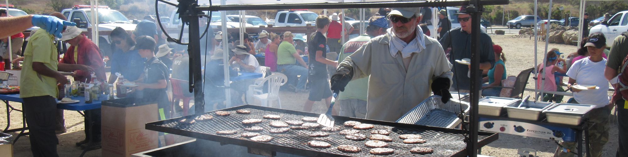
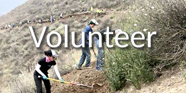
The Conejo Open Space Foundation is dedicated to helping preserve, promote and protect natural open space through community education and involvement. We support these efforts by fundraising and volunteer engagement.
Connecting community and nature for more than 30 years!


Upcoming Events
News from COSF (View all the updates.)
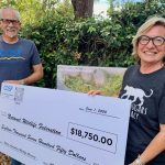 COSF Support for Wildlife Crossing Reaches $50,000 Total (7/17/2026) - With an $18,750 check presented on July 13 by President Bill Miller to National Wildlife Federation Deputy Director for California Lauren Gill, COSF is proud to have contributed a total of $50,000 toward the construction of the Wallis Annenberg Wildlife Crossing. COSF’s first donation in support of the crossing was made in June, 2020, with COSF pledging $10,000. Over the… (read more...)
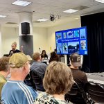 Speaker Series special community event on rattlesnake safety draws crowd–watch the recorded presentation (7/16/2026) - Dana Stangel, executive director of Teranga Ranch, and John Noble, Conejo Open Space Foundation board member and rattlesnake relocator, addressed an enthusiastic and inquisitive crowd of about 80 people June 3. During “Living with Rattlesnakes: What Ventura County Residents Need to Know” the pair focused on dispelling myths, explaining typical rattlesnake behaviors, exploring the impacts of climate change on snakes,… (read more...)
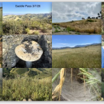 Photos from the Conejo Open Space Challenge (7/3/2026) - Not all photos submitted by the participants of the 2026 Conejo Open Space Challenge fit neatly into a category, and those are shown here, plus a few that might have been overlooked from an earlier collection. We hope you enjoy scrolling through them as much as the participants enjoyed taking them! If you would like to see earlier galleries with… (read more...)
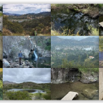 Waterways of the Conejo Open Space Challenge (7/2/2026) - Today’s theme is Water– photos that participants of the 2026 Conejo Open Space Challenge have submitted that show the water they encountered while traveling the trails. We hope you enjoy scrolling through them as much as the participants enjoyed taking them! If you would like to see earlier galleries with different themes, visit the Conejo Open Space Challenge page, and… (read more...)
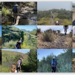 Conejo Open Space Challenge Photos: Lead the Way! (7/1/2026) - Today’s theme is Lead the Way – photos that participants of the 2026 Conejo Open Space Challenge have submitted that show the trails they’re traveling on. We hope you enjoy scrolling through them as much as the participants enjoyed taking them! If you would like to see earlier galleries with different themes, visit the Conejo Open Space Challenge page, and… (read more...)
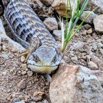 Step Lightly – Photos from the Conejo Open Space Challenge (6/30/2026) - "Watch your step!" Photos from the participants of the 2026 Conejo Open Space Challenge. This is the smallest gallery of the series. You may be relieved to hear that! We hope you enjoy scrolling through them as much as they enjoyed avoiding them! (read more...)
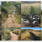 Trails of the Conejo Open Space Challenge (6/30/2026) - Today's theme is Trails - photos that participants of the 2026 Conejo Open Space Challenge have submitted that show the trails they're traveling on. We hope you enjoy scrolling through them as much as the participants enjoyed taking them! If you would like to see earlier galleries with different themes, visit the Conejo Open Space Challenge page, and scroll down… (read more...)
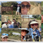 Faces of the Conejo Open Space Challenge (portrait edition) (6/29/2026) - Today's topic is Selfies - taken by participants of the 2026 Conejo Open Space Challenge. We hope you enjoy scrolling through them as much as they enjoyed taking them! Selfies that are in landscape orientation were posted last week. If you would like to see earlier galleries with different themes, visit the Conejo Open Space Challenge page, and scroll down… (read more...)
News from COSF (View all the updates.)
COSF Support for Wildlife Crossing Reaches $50,000 Total (7/17/2026) - With an $18,750 check presented on July 13 by President Bill Miller to National Wildlife Federation Deputy Director for California Lauren Gill, COSF is proud to have contributed a total of $50,000 toward the construction of the Wallis Annenberg Wildlife Crossing. COSF’s first donation in support of the crossing was made in June, 2020, with COSF pledging $10,000. Over the… (read more...) Speaker Series special community event on rattlesnake safety draws crowd–watch the recorded presentation (7/16/2026) - Dana Stangel, executive director of Teranga Ranch, and John Noble, Conejo Open Space Foundation board member and rattlesnake relocator, addressed an enthusiastic and inquisitive crowd of about 80 people June 3. During “Living with Rattlesnakes: What Ventura County Residents Need to Know” the pair focused on dispelling myths, explaining typical rattlesnake behaviors, exploring the impacts of climate change on snakes,… (read more...) Photos from the Conejo Open Space Challenge (7/3/2026) - Not all photos submitted by the participants of the 2026 Conejo Open Space Challenge fit neatly into a category, and those are shown here, plus a few that might have been overlooked from an earlier collection. We hope you enjoy scrolling through them as much as the participants enjoyed taking them! If you would like to see earlier galleries with… (read more...) Waterways of the Conejo Open Space Challenge (7/2/2026) - Today’s theme is Water– photos that participants of the 2026 Conejo Open Space Challenge have submitted that show the water they encountered while traveling the trails. We hope you enjoy scrolling through them as much as the participants enjoyed taking them! If you would like to see earlier galleries with different themes, visit the Conejo Open Space Challenge page, and… (read more...) Conejo Open Space Challenge Photos: Lead the Way! (7/1/2026) - Today’s theme is Lead the Way – photos that participants of the 2026 Conejo Open Space Challenge have submitted that show the trails they’re traveling on. We hope you enjoy scrolling through them as much as the participants enjoyed taking them! If you would like to see earlier galleries with different themes, visit the Conejo Open Space Challenge page, and… (read more...) Step Lightly – Photos from the Conejo Open Space Challenge (6/30/2026) - "Watch your step!" Photos from the participants of the 2026 Conejo Open Space Challenge. This is the smallest gallery of the series. You may be relieved to hear that! We hope you enjoy scrolling through them as much as they enjoyed avoiding them! (read more...) Trails of the Conejo Open Space Challenge (6/30/2026) - Today's theme is Trails - photos that participants of the 2026 Conejo Open Space Challenge have submitted that show the trails they're traveling on. We hope you enjoy scrolling through them as much as the participants enjoyed taking them! If you would like to see earlier galleries with different themes, visit the Conejo Open Space Challenge page, and scroll down… (read more...) Faces of the Conejo Open Space Challenge (portrait edition) (6/29/2026) - Today's topic is Selfies - taken by participants of the 2026 Conejo Open Space Challenge. We hope you enjoy scrolling through them as much as they enjoyed taking them! Selfies that are in landscape orientation were posted last week. If you would like to see earlier galleries with different themes, visit the Conejo Open Space Challenge page, and scroll down… (read more...)Follow us on social media
 |
 |